
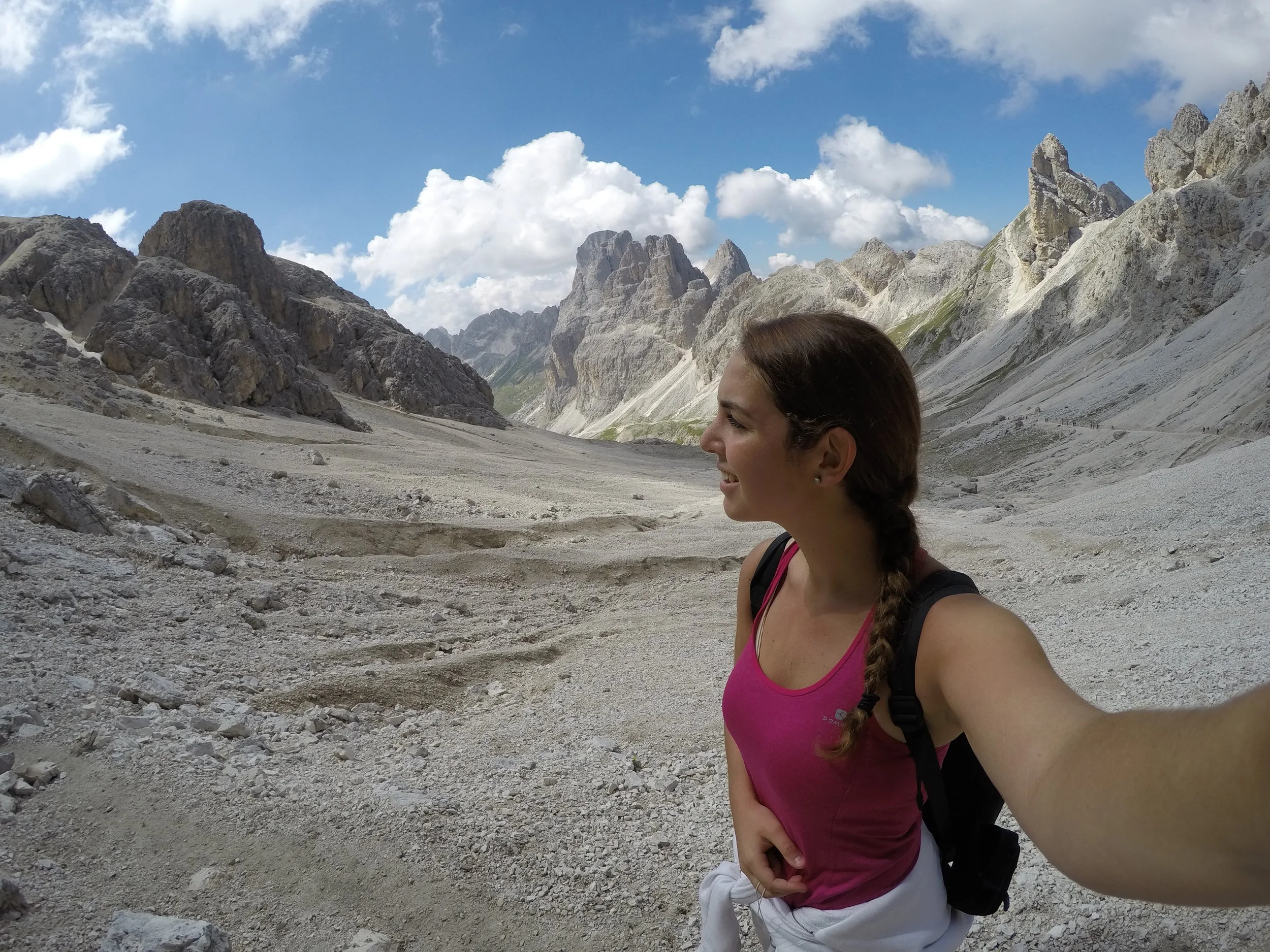
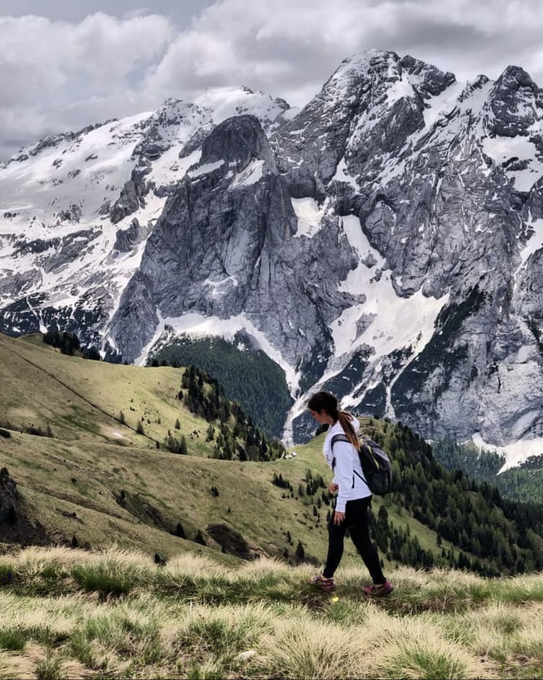
Top 10 hidden gems in the Dolomites

“The harder the climb the better the view”
Growing up in the Dolomites I was part of the fast touristic growth of my region. Thanks to Social Media, people have discovered the photogenic features of these beautiful mountains and the perfect lifestyle around them, which includes different hobbies possible to practice all year round, like climbing, skiing, paragliding, paddle-boarding, ice skating, biking and many others.
What I noticed, due to social media, is that people tend to explore only the most photographed locations, instead of adventuring in nature, forgetting the whole concept of ‘wanderlust’. Most of the time people are just getting disappointed, because they will never get the same atmosphere and authenticity in the crowds, as those social media pictures suggest.
That’s why I’m happy to share with you, my secret favourite spots in my region, with a top 10 list of hidden gems in the Dolomites.

TABLE OF CONTENTS
LAGO PISCIADU`
circuit trail option ∙ intermediate level ∙ 5 h 30 ∙ 10 km
DENTI DI TERRAROSSA
intermediate level ∙ 6 h ∙ 12 km
SASSOLUNGO
circuit trail ∙ easy-intermediate level∙ 4 h 45 ∙ 12 km
VIA FERRATA MASARE`
circuit trail ∙ intermediate-high level ∙ 5-6 h ∙ 8,2 km
LAGO DI ANTERMOIA
circuit trail ∙ intermediate level ∙ 5-6 h ∙ 16 km
PALE DI SAN MARTINO
circuit trail ∙ intermediate-high level ∙ 6 h ∙ 12 km
VIEL DEL PAN
easy level ∙ 3 h ∙ 6 km
SASSO PORDOI
easy level
LAGO DI TOVEL
circuit walk ∙ easy level ∙ 1 h 30 ∙ 3 km
PASSO SAN NICOLO`
circuit trail ∙ easy level ∙4 h 30 ∙ 12 km
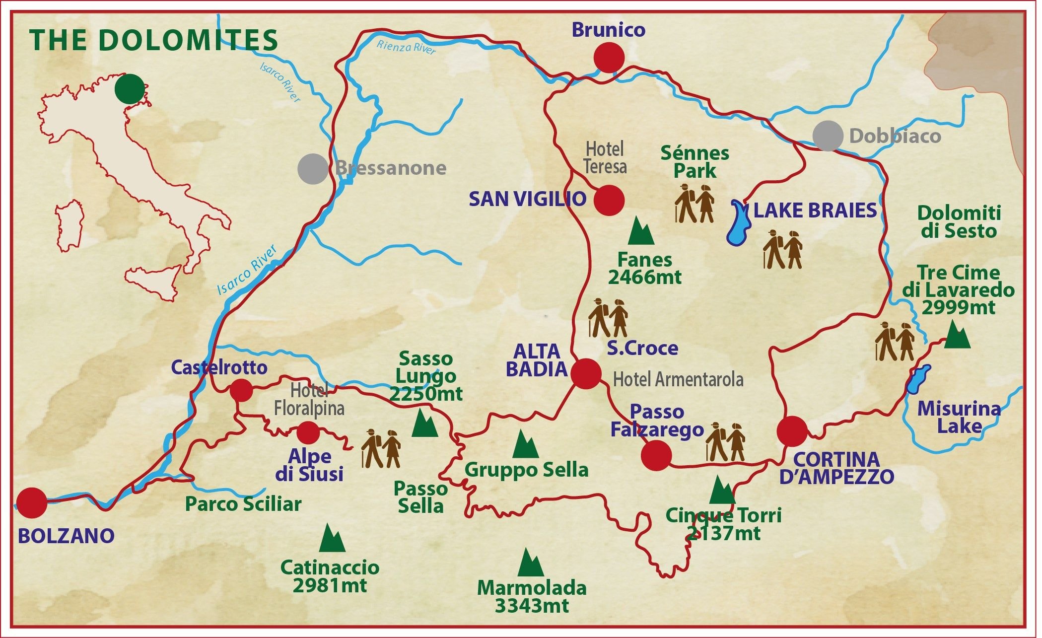
📍BUT FIRST.. A BIT OF GEOGRAPHY
The Dolomites are located in the northeast of Italy, between the Austrian border in the north and the big Venetian plain in the south. They lie in the regions of Trentino Alto-Adige/Südtirol, Veneto and Friuli Venezia Giulia. “Marmolada” is the highest mountain of the Dolomites (3,343 m / 10,968 ft). We have 3 official languages: Italian, German and Ladin.
✔ GENERAL HIKING TIPPS
I recommend to start hiking early in the morning, between 7 - 8 AM. It’s always better to take it easy, and avoid the late afternoon storms, that are typical in the summer in the Alps.
Bring snacks or protein bars to keep the energy high. Take with you a lot of water to stay hydrated. A must—is a rain jacket, because the mountain weather is very unpredictable at these elevations.
Often, to reach some hiking trails is necessary to take a cable car first. Take into consideration that they are not working off-season — in November and April.
☂ WHEN TO GO
The best season for exploring the Dolomites is from May until late September. August is the busiest month, especially around the 15th, in “Ferragosto” — an Italian Summer Holiday.
My favourite months are May and September, for the weather conditions, and because there are not many people around. If you want to avoid crowds along the way, I suggest you going on weekdays. Locals and tourists hike at the weekends — Sundays are usually very busy.
LAGO PISCIADU`
CIRCUIT TRAIL (longer hike option) • From Sasso Pordoi to Lago Pisciadu`
⏰ 5 h 30 • 🥾 10 km • ⛰ intermediate
📍STARTING POINT:
Sasso Pordoi, Val di Fassa, Italy
✔ LOCATIONS:
Sasso Pordoi - Lago Pisciadu`- Corvara check the map
⇢ TRAILS:
627 - 647A - 666 - 676 - 651
| ELEVATION:
from 2950 m - to 2585 m
| PRICE:
€ 15,00/pax (gondola lift + bus)
☒ACCOMODATION:
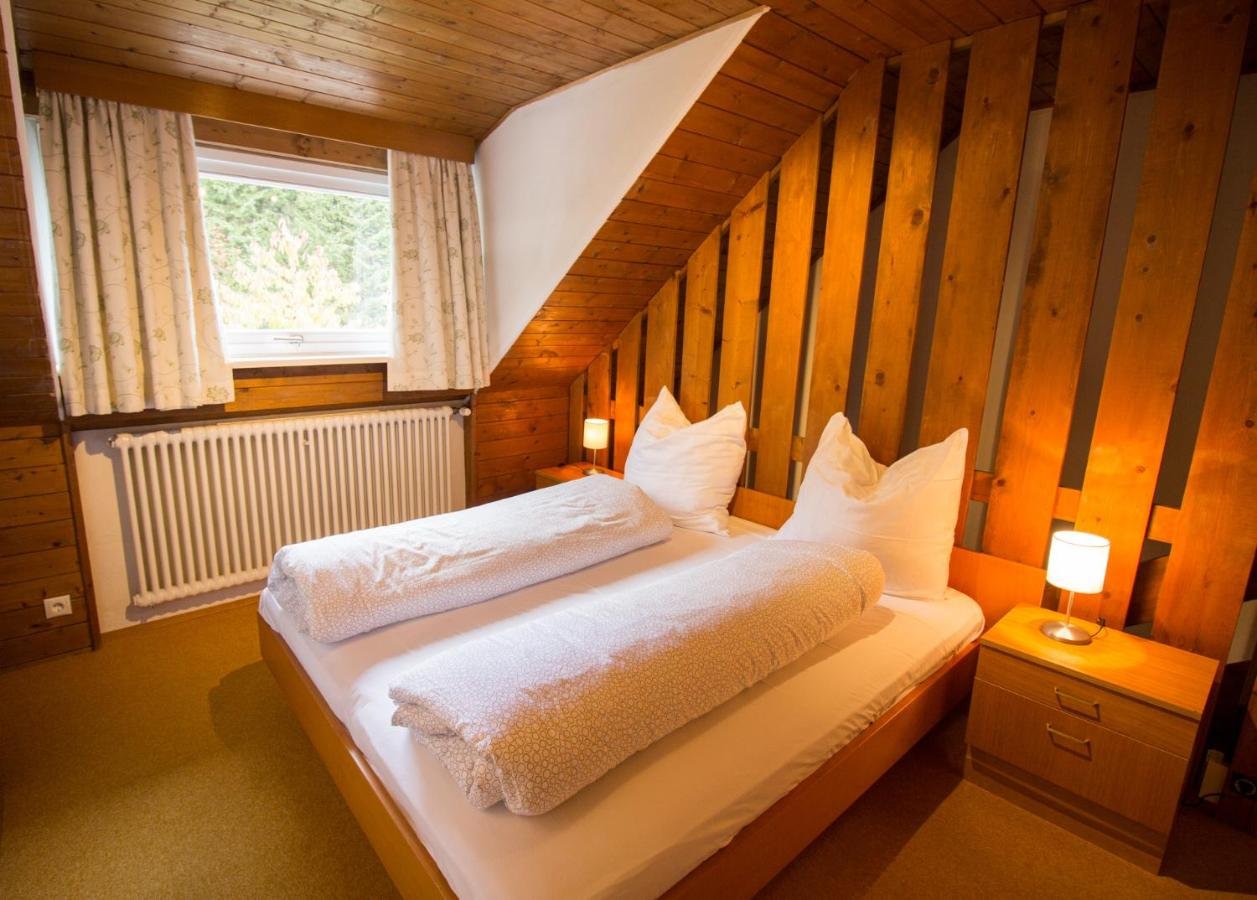
Fedaia Joy B&B

Enjoy the view of the Dolomites directly from your balcony. The rooms have an Alpine feel, featuring wooden furniture, in a calm & relaxing environment. After a hike, you can relax in the sauna, or enjoy a hot tub and a steam room. The B&B is very close to the cable cars and Canazei's main attractions
THE HIKE
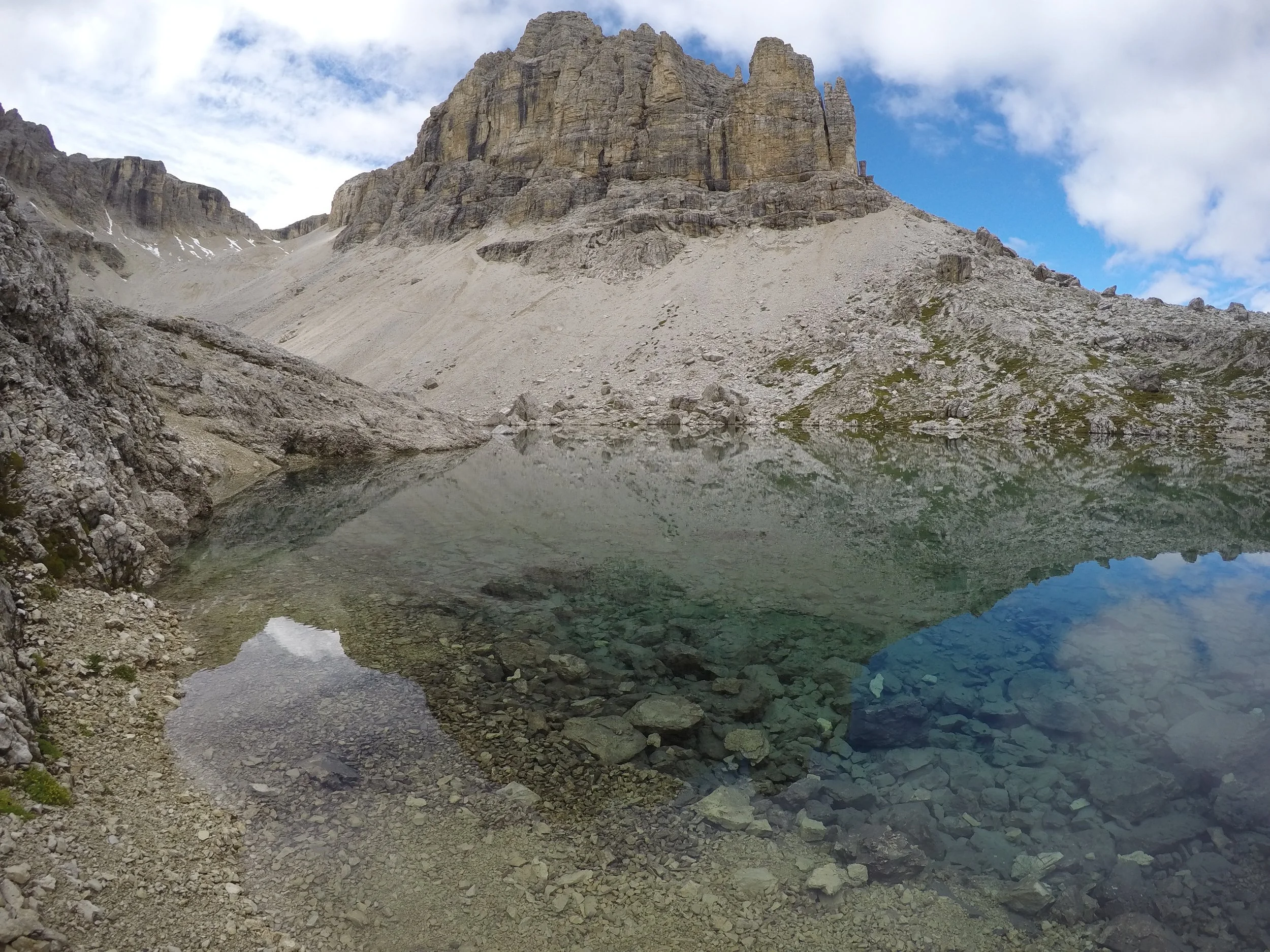
This intermediate-level circuit hike is located at 2,585 m in the heart of the Sella Group. On the way, you will find a beautiful mountain lake, named Lake Pisciadù, in Ladin called ‘Lech dl Pisciadù’. The mountain hut on its waterfront, (built-in 1902), is located in a suggestive rocky-lunar landscape.
Personally, I prefer this circuit trail to the shortened option, mostly due to its beautiful views throughout the hike. Even though the distance is longer, it’s less steep, considering that you start from an elevation of 2950 m, and you don't have to come back from the same way which you began.
In the final part of the hike, you will find a short aided path. Here, It’s not necessary to use the harness, it’s just suggested for precaution and for children.

View of the lake from the Trail 666
HOW TO REACH THE LAKE?
Take the local bus from the village of Corvara to Passo Pordoi.
Bus n. 472 at 08:18⇢08:58 or at 10:18⇢10:58
It costs € 3,00/pax and the trip duration is 40 minutes.
Take the lift from Passo Pordoi to Sasso Pordoi - € 12/pax one way
Take the trail n. 627 - then continue with the trail n. 647A
To reach Rifugio Cavazza al Pisciadu` - you will see a hike going down on the right side with the n.666 (picture above). Once arrived, you can take some pictures of the turquoise ‘Lago Pisciadu’, hidden in the majestic ‘Gruppo Sella’ mountain range.
When you are ready to start heading home, follow the trail 676, followed by trail 651 — that will lead you back to📍Corvara, the starting point. On the way down to the village, you will also find a short 5 minutes Via-ferrata trail. Here, it’s not necessary to use the harness, it’s just suggested for precaution and for children.
SHORTER HIKE OPTION • From Passo Gardena to Lago Piscidu´
⏰ 3 h • 🥾 5 km • ⛰ intermediate

Unlike the other path, here, you return to the same point you started from. This trail is steeper than the other one, but is 5 km shorter. You don’t have to take the gondola lift or the bus. The only negative side if you choose this trail, is that you are gonna miss the breathtaking lake view from above, because you will arrive at the mountain hut from below.
📍STARTING POINT:
Passo Gardena (2121 m)- Italy
✔ LOCATIONS:
Passo Gardena - Lago Pisciadu` check the map
⇢ TRAILS:
666 - 676
| ELEVATION:
from 2136 m - to 2585 m
| PRICE:
€ 0,00
☒ACCOMODATION:
HOTEL CIR

The sun terrace offers panoramic views of the Sassolungo Group, with Tyrolean-style rooms. A relaxing getaway, where to admire the stunning nature of the Dolomites.
HOW TO REACH THE HIKE’S STARTING POINT?
From the parking in Passo Gardena, take the trail n.666 (Alta Via Delle Dolomiti).
Be prepared for the steep part of the hike, that follows the trail n.676 — it leads all the way up to the beautiful Pisciadu` Lake. Here, you can eat and rest in the mountain hut ‘Rifiugio Cavazza al Pisciadu`’.
Go back to Passo Gardena, following the same trail where you began.

2. DENTI DI TERRAROSSA
⏰ 6 h • 🥾 12 km • ⛰ intermediate
An interesting fact about the mountain name ‘‘Denti di Terrarossa”, when translated to English it means ‘‘Red Earthen Teeth’’, the name comes from the phenomenon which happens during sunrise and sunset, when the mountains shaped like teeth, change colour to red, hence the name: Red Earthen Teeth.
📍STARTING POINT:
Campitello di Fassa, Italy
✔ LOCATIONS:
Campitello di Fassa - Passo Duron - Forcella Denti di Terrarossa check the map
⇢ TRAILS:
532 - 594
| ELEVATION:
from 1448 m - to 2525 m
| PRICE:
€ 0,00
☒ACCOMODATION:
APPARTAMENTI LADINA

Located in a quiet area of Campitello di Fassa, these Alpine-style apartments are very close to the village’s centre and the starting point of the hike. The accommodation offers a dining area, one bedroom and a comfortable leaving room with incredible views, all for an affordable price!
THE HIKE
| HOW TO REACH IT?
From Campitello di Fassa take the trail going to Rifugio Micheluzzi — a mountain hut, where you can have breakfast, or take a morning coffee. After the break, you can follow the trail n.532 -along the amazing green valley called Val Duron.
Continue the path, in the direction of Passo Duron (2188 m), which you will reach in 1 hour. Later, continue for 1-2 hours with the trail n. 594 - towards Rifugio Alpe di Tires (2440 m).
Once reached the top of the plateau, I recommend eating in the beautiful mountain cabin — Alpe di Tires, which is famous for its delicious cheese tasting.
After the well-deserved stop, you continue the hike for 10 minutes, and you will finally reach your destination — Forcella Denti di Terrarossa at 2525 m, where you can enjoy the breathtaking 360° view. Here, the panorama of the Alpe di Siusi, Mt Sciliar and the Dolomites, is very impressive. The green meadows and beautiful alpine flowers contrast with the impressive peaks of ‘‘Denti di Terrarossa’’, which seem to grow out of the ground like Gothic cathedrals.
Once you are ready to lead back home, follow the direction of Campitello di Fassa, with the same trail you began on.

3. SASSOLUNGO
CIRCUIT TRAIL around Sassolungo
⏰ 4 h 45 • 🥾 12 km • ⛰ easy-intermediate
The circuit trail around the Sassolungo mountain group, in the western Dolomites — is considered to be the borderline between the Gardena and the Fassa Valleys. The hike itself is pretty easy, it can get exhausting just for its length. The mountain massif, (originally a coral reef), is well-known for its climbing routes, such as the Via Ferrata Oskar Schuster and the Friedrich August Trail. The highest summit, name-giving Mt Sassolungo — boasts an altitude of 3,181 meters.
📍STARTING POINT:
Passo Sella, Val Gardena, Italy (2218 m)
✔ LOCATIONS:
Passo Sella - Forcella del Sassolungo - Friedrich August path - Col Rodella check the map
⇢ TRAILS:
525 - 527 - 357
| ELEVATION:
from 2685 m - to 2400 m
| PRICE:
€ 17,00/pax (cable car)
☒ACCOMODATION:
Passo Sella Dolomiti Mountain Resort

A picturesque resort located at the foot of Sassolungo. The Hotel offers many amenities, like — Finnish sauna, indoor pool, gym and massage service.
THE HIKE
| HOW TO REACH IT?
Take the cable car from Passo Sella to Forcella del Sassolungo · €17/px one way
Start the hike following the trail n.525 to Rifugio Vicenza, which is so far my favourite mountain cabin in the Dolomites, because it’s placed in a stunning location hidden in the mountain peaks of Sassolungo. I always stop here for a rich breakfast, and to take some pictures.
Spot my favourite mountain hut
After leaving the hut, continue with the trail n.527. It will take at least 2 hours to reach the next hut called Rifugio Sassopiatto — the most popular mountain restaurant in the area.
Continue for 2 hours with the trail n.357 called Friedrich August path, which will lead you all the way to Col Rodella, 30 minutes away from the starting point — Passo Sella. It’s not necessary to take the cable car on the way back, because you will arrive at the foot of the mountain where you started on.

4. VIA FERRATA MASARE`
CIRCUIT TRAIL
⏰ 2 h hike + 3/4 h Via Ferrata • 🥾 8,2 km • ⛰ intermediate-high
If I would have to judge the technical aspect of the aided path (Via Ferrata), it would be an easy level — if you are not afraid of heights. Is important to know, that before reaching the Via Ferrata, first, you have to hike a steep mountain section — that’s why I ranked the circuit trail intermediate-high level.
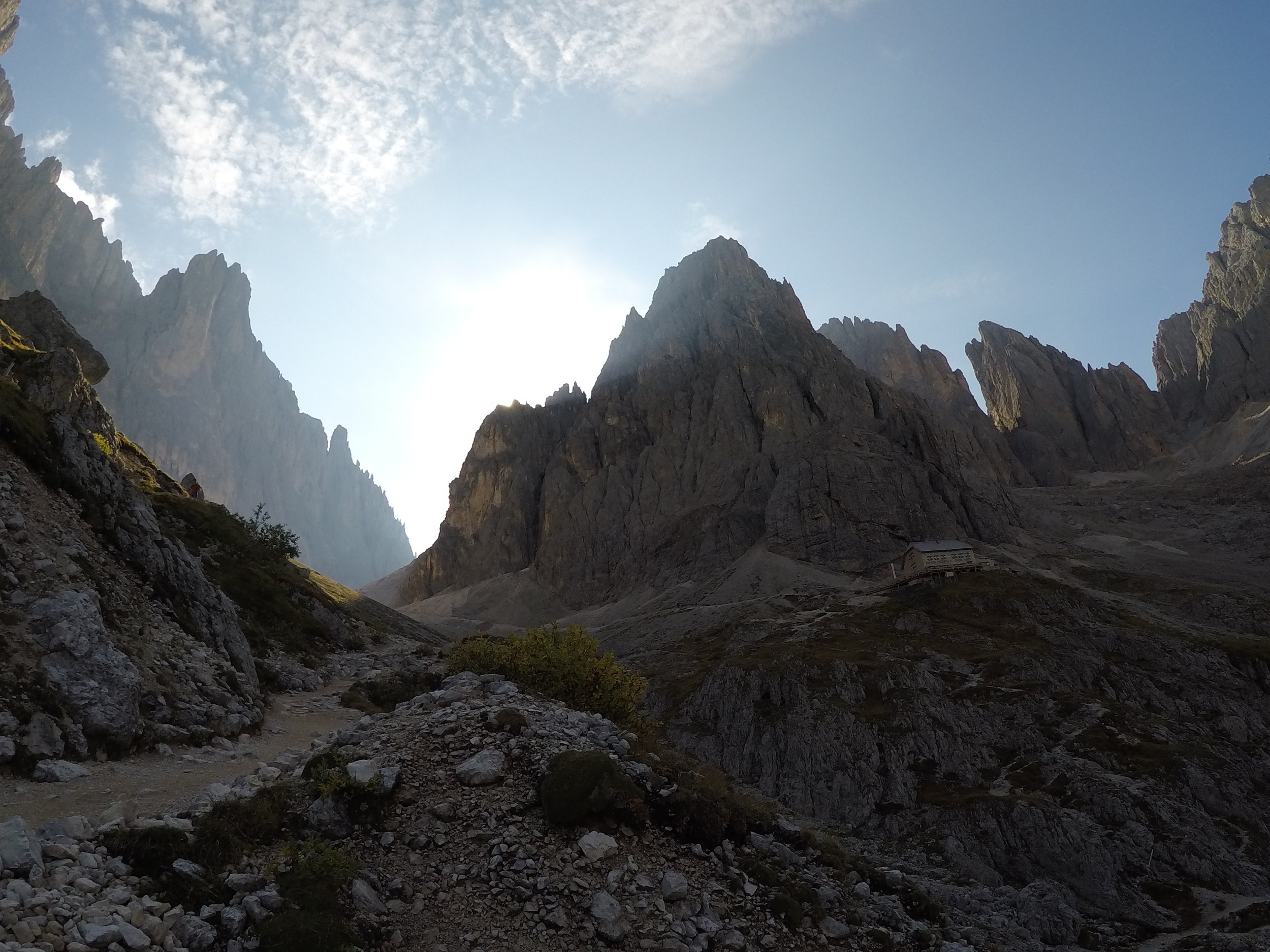
The hike takes 1 hour before you reach the aided path. Once you are at the summit, you can enjoy the spectacular view of the “Rosengarten” natural park.
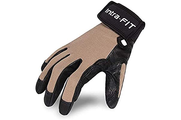
For the Via Ferrata, take with you — harness, helmet and climbing gloves, to have a better grip. I recommend checking the weather forecast in advance, Is always better to do this hike on a sunny day, so that you can enjoy the spectacular 360 ° view of the Catinaccio mountain group and Roda di Vael.
📍STARTING POINT:
Carezza, South Tyrol, Italy
✔ LOCATIONS:
Carezza - Rifugio Paolina - Vajolon Pass - Roda di Vael check the map
⇢ TRAILS:
552 - 551 - 549 - 539
| ELEVATION:
from 2125 m - to 2727 m
| PRICE:
€ 18,00/pax (chairlift)
☒ACCOMODATION:
Residence Chris Appart
Only 300 m from the Carezza cable car and 1 km from Lake Carezza, Residence Chris Appart boasts a wellness area, a furnished garden with a terrace and free BBQ facilities. You can enjoy the views of Mount Latemar and the Rosengarten massif directly from your balcony. The apartments include a Turkish bath, a Finnish sauna, as well as an infrared sauna.
| EQUIPMENT:
CLIMBING HARNESS
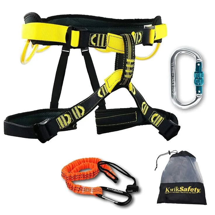
Via ferratas are very steep and exposed trails. The steel cable allows you to attach yourself to it with a climbing harness, to reduce the risk of falls. This harness is very comfortable and light to carry in your backpack.
CLIMBING HELMET
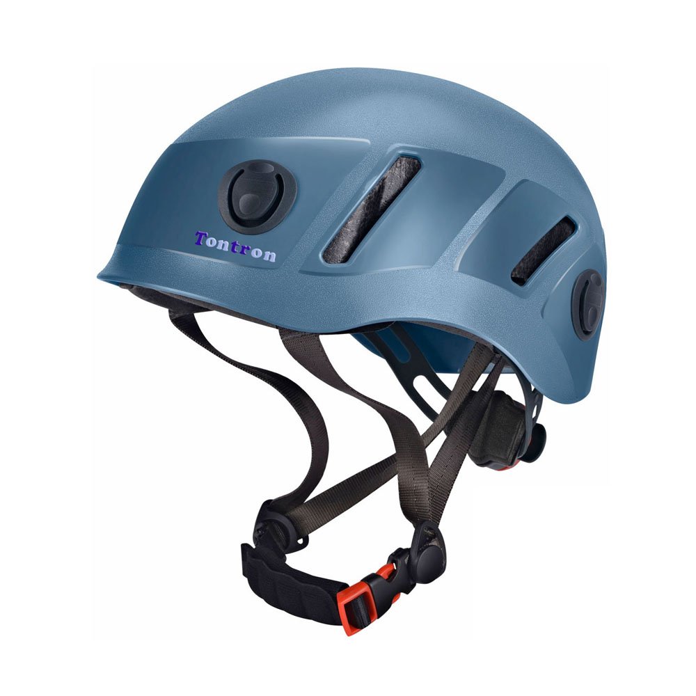
Many people underestimate the use of helmets while climbing, however, mountains are an unpredictable environment, and having a helmet can be a life saviour, in case of falling rocks.
| HOW TO REACH THE HIKE?
Take the chairlift “Paolina” from Carezza (near Passo di Costalunga) to Rifugio Paulina.
It’s open from 8.00-8.30 AM to 5 PM. The chairlift price is: € 18/pax for both ways.
Once you reached the Paolina mountain cabin, take the trail n.552. Half an hour later, you will see a steep hike, called “Pas dal Vajolon” path n. 551 — going all the way to the start of the Via Ferrata.
The aided path is signed — Via Ferrata Majare`. Take into consideration that in some parts the exposure can be significant, so if you are scared of heights, that’s definitely not for you. To be completely honest, I attempted this Via Ferrata twice. The first time I was by myself and I was just mentally not prepared, so I didn’t even manage to do half of the trail, before turning back. The second time, I wanted to try it again, so I came back one week later after the first attempt. On the way, I met 2 friendly climbers, that asked me If I wanted to join them. The experience when you share it with someone else is completely different. It’s easier If you have people, that can help and motivate you when needed. Especially, if they are more experienced than you.
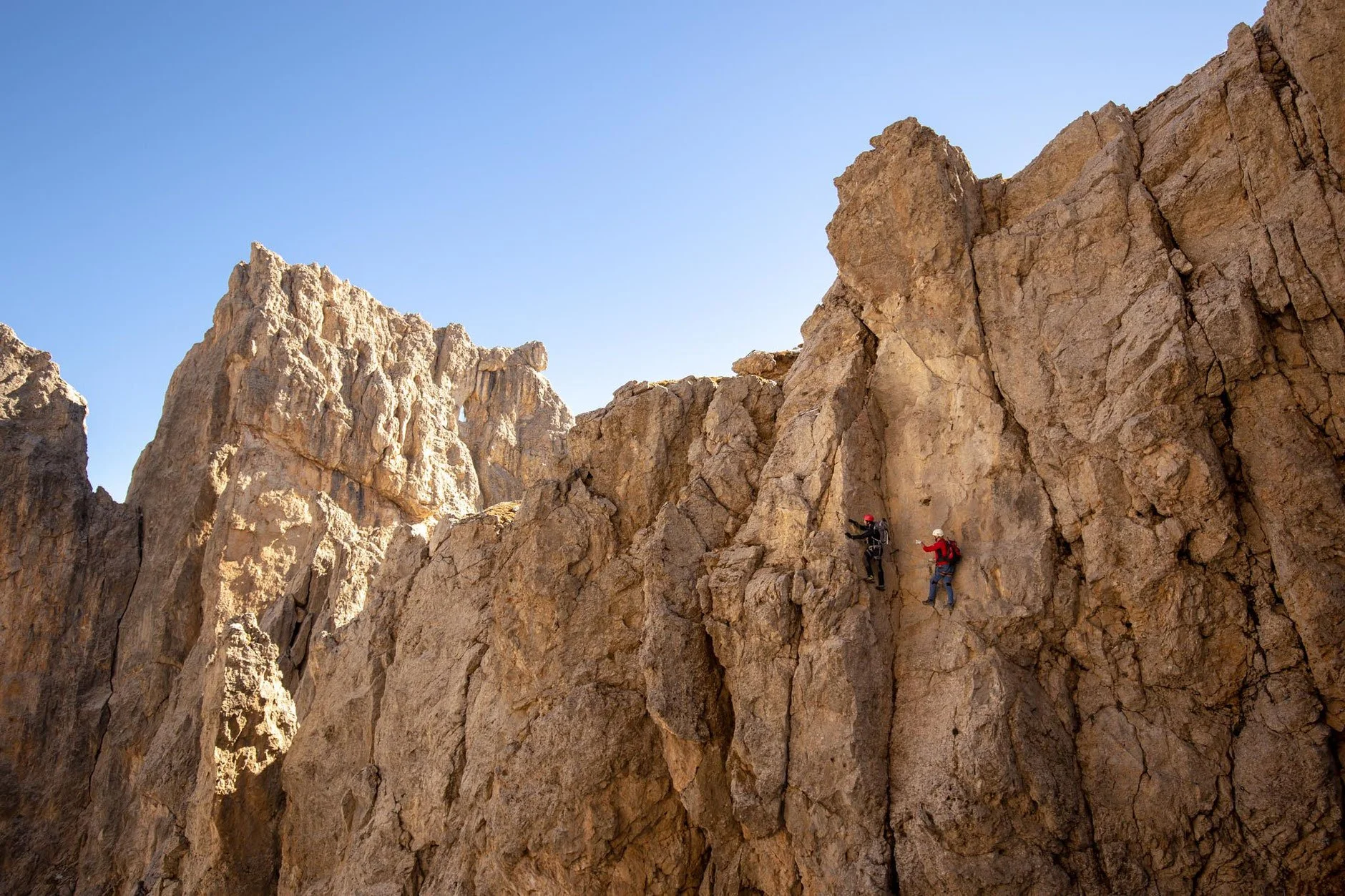
The most challenging section of the Via Ferrata - the face traverse that connects the mountain Cresta de Masare` with Mount Roda di Vael

Roda di Vael summit - 2585 mt
Once you are finished with the Via Ferrata, you will start descending, and you will arrive at the mountain cabin of Rifugio Roda di Vael, where you can have a well-deserved meal. I recommend trying the “Strudel” — a typical local apple pie, that we often have after a long hiking day.
To reach the chairlift, take the trail n.549 and then n.539 — back to Rifugio Paulina. In the summer, the last chairlift descent is at 5 PM.
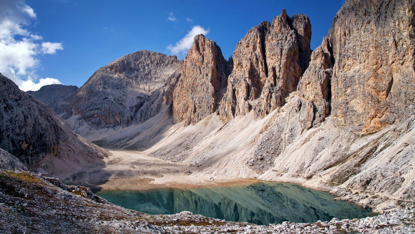
5. LAGO DI ANTERMOIA
CIRCUIT TRAIL
⏰ 5-6 h • 🥾 16 km • ⛰ medium
The Antermoia lake is one of the highest (2,496 m) and most picturesque lakes in the Dolomites. Of glacial origin, with its emerald-colored waters leaves anyone enchanted. It is fed by the melting of the snow present in the valley and therefore its extension is very variable.
Antermoia Lake — plays a large part in Ladin tradition and culture. Antermoia is the name of a beautiful nymph that lived in the waters of the lake of the “Rosen Garden” (Rosengarten). There are many Ladin legends, portraying this spectacular lake.
📍STARTING POINT:
Vigo di Fassa, Val di Fassa, Italy
✔ LOCATIONS:
Vigo di Fassa - Val del Vaiolet - Lago di Antermoia - Passo di Dona - Fontanazzo check the map
⇢ TRAILS:
540 - 546 - 584 - 580
| ELEVATION:
from 1998 m - to 2500 m
| PRICE:
€ 12,50/pax (chairlift + bus)
☒ACCOMODATION:
Hotel Garnì Carpe Diem

The Carpe Diem is a small family-run Hotel with a wellness centre. It’s set in the Catinaccio ski area between Vigo di Fassa and San Giovanni. The individually decorated rooms of Hotel Garnì Carpe Diem are bright and have a private balcony. The wellness centre includes an indoor pool, a hot tub, a sauna, a Turkish bath, and relaxation areas. A variety of beauty treatments and massages can be booked.
| HOW TO REACH THE HIKE?
Once arrived in the village - Vigo di Fassa in the Fassa Valley, take the chairlift to Rifugio Ciampedie. The chairlift opening times in the Summer are from 8 AM until 6 PM. The price is € 10,50/pax one way, or € 20/pax two ways.
Once arrived at the foot of the mountain, take the trail n.540 to Rifugio Gardeccia. The hike is gonna take 45 minutes. You will cross a magnificent forest full of rhododendrons with the Vajolet Valley front view. In distance you can also spot the Marmolada glacier and the mountain group of Sassolungo. The mountain cabin of rifugio Gardeccia is open the whole summer, if you want to buy some snacks, or have breakfast before the longer part of the hike.
From the mountain cabin, continue the rocky path n.546 for 50 minutes to Rifugio Vajolet, located at 2243 m, from where you can see the beautiful viewpoint of the Catinaccio mountain group.
Follow the steep trail n.584 for 20 minutes to Lago di Antermoia. Once you reach the plateau, you start descending towards the rocky valley for 15 minutes, all the way to the beautiful lake.
Once reached the Antermoia Lake, you can stop here to take some pictures, or have a picnic. If you want, you can also take a swim, just take in consideration that the lake is just 10 °C.
5 minutes after the lake, there is a mountain restaurant — Rifugio di Antermoia, where you can refresh with an “Adler” — a typical Bavarian drink, combined with beer and lemonade.

Rifugio di Antermoia 2496 m
After the mountain restaurant, continue with the trail n.580, following the sign towards Passo di Dona. You will cross a beautiful green valley called Val del Dona, that goes all the way to Fontanazzo village, for 2 hours and 30 minutes.

The Dona Valley
To go back to Vigo di Fassa (the location where you started from), there is a bus every 20 minutes, that will cost you € 2-3 /px. The bus ride takes 15 minutes.

6. PALE DI SAN MARTINO
CIRCUIT TRAIL
⏰ 6 h • 🥾 12 km • ⛰ intermediate-high
This demanding day hike feels like an intimate exploration of the Pala range. You’re hiking in the very heart of the Pale di San Martino mountains. The trail starts from Rifugio Rosetta and continues all the way to Rifugio Pradidali, and it feels like walking on the moon.
📍STARTING POINT:
San Martino di Castrozza, Italy
✔ LOCATIONS:
San Martino di Castrozza - Rifugio Rosetta - Val di Roda - Passo di Ball - Val Pradidali - Passo Pradidali Basso - Rifugio Rosetta check the map
⇢ TRAILS:
702 - 715 - 709 - 707
|ELEVATION:
from 2581 mt - to 2658 mt
|PRICE:
€ 25,00/pax (cablecar)
☒ACCOMODATION:
Hotel Savoia dal 1924

This hotel features stylish rooms in the heart of the Paneveggio Natural Park. Set in the town of San Martino di Castrozza, the hotel's restaurant serves international food and a nice selection of Tyrolean wines. Every morning, guests can enjoy a rich breakfast buffet. Some of the facilities at the Savoia include a fitness centre, a sauna, and an outdoor playground for kids.
| HOW TO REACH THE HIKE?
Take the Colverde gondola located in San Martino di Castrozza. There’s a free parking lot at the valley station. Take into consideration that the cable car is open from late June until mid-October, with operating times from 8:10 AM to 4:45 PM. From late September, until mid-October the cable car it’s open only at the weekends.
After the Colvedere gondola take the Rosetta cablecar. The ticket for both gondolas - two ways - costs € 25/px. The circuit trail around Pala di San Martino begins at Rifugio Rosetta, where you will arrive with the gondolas.
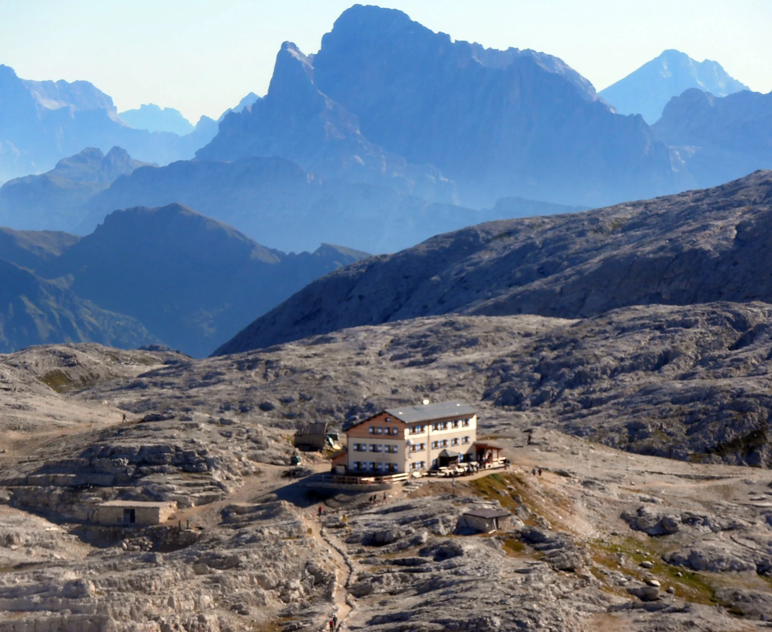
Arrival at Rosetta’s mountain hut - 2581 m
From the hut, take the trail n.702 to Rifugio Pradidali, signed 2 hours. Halfway, you will reach a dramatic track zigzagging its way up from Val di Roda to the plateau. Continue following this linear path – now trail n.715.

Zigzag trail n. 715 - no climbing equipment needed, but I highly recommended to use hiking gloves
With the help of fixed cables, you’ll ascend to Passo di Ball along narrow passages. This is a rather long secured passage, but it’s not overly difficult for experienced hikers, and it makes the hike, far more interesting. From this mountain pass, you will have a spectacular view, between two mountain peaks: Cima di Ball and Cima Pradidali.
From Passo di Ball, trail 715 — descend to the mountain hut called Rifugio Pradidali, where you can stop to eat.

Viewpoint of Rifugio Pradidali - 2278 m
From Rifugio Pradidali, follow trail n.709 in the direction of Lago Pradidali. The trail ascends the upper Val Pradidali, all the way to the central plateau of Pale di San Martino. After passing the small lake, the trail steadily climbs up the valley, and you will reach an intersection (45 minutes after leaving the hut) — turn left and stay on trail 709.

View from trail n.709 — Pradidali Lake
Continue hiking up another 25 minutes to reach Passo Pradidali Basso at 2658 m, which looks like an entryway to the vast lunar landscape of Altopiano Pale di San Martino. Follow the painted waymarks across the rolling rockscapes, and join the trail n.707, bearing left, back to the starting point - Rifugio Rosetta, where you will find the cableways.

7. VIEL DEL PAN
⏰ 3 h • 🥾 6 km • ⛰ easy
This trek is special because, although it is easy and suitable for everyone, it offers unique views, that take your breath away. It takes one hour and a half to get to Viel Dal Pan Refuge, starting from the Pordoi Pass. The difference in height to be covered is modest — about 200 meters, with a hiking distance of 6 kilometres.
📍STARTING POINT:
Passo Pordoi, Val di Fassa, Italy
✔ LOCATIONS:
Passo Pordoi - Viel del Pan - Fedaia Lake check the map
⇢ TRAILS:
601
|ELEVATION:
elevation from 2239 mt - to 2432 mt
|PRICE:
€ 0 - € 5,00 (if you take the bus)
☒ACCOMODATION:
Hotel Pordoi Passo Pordoi
Located at an elevation of 2,239 m, this Hotel offers 360° panoramic views of the Dolomites. The cable car that reaches the top of Pordoi mountain (2950 m) — is located right in front of the accomodation. This Hotel is at the bordeline with 2 regions (Trentino Alto Adige and Veneto), and is the starting point for the most stunning hikes in the Dolomites.
| HOW TO REACH THE HIKE?
You can choose where you want to start the hike. If you want to spare some kilometres with the car, you can leave it in the centre of Canazei, in the Fassa Valley. Take the line bus n.471 to Passo Pordoi, which goes up every hour, from 9 AM - until 5 PM. The price is €5/px - two ways. I recommend this option if you want to save money (€ 15-€ 20), instead of taking the 2 cablecars from Canazei, all the way up. The distance by bus it’s 7 km - 15 minutes.
Another way, also the easiest and shortest one, is to drive all the way up to Passo Pordoi at 2239 meters elevation, where you will find free parking on the arrival.
The hike starts on the left side of "Hotel Savoia". Follow the dirt road that leads to a chapel. From here the road narrows and path n.601 begins, which will lead you to the Fredarola Refuge at an altitude of 2370 meters. From this point, the view opens up and leaves you breathless. Surrounded by green meadows and facing the imposing Marmolada glacier.
Marmolada glacier 3343 mt
Continue with path n.601 called “Viel del Pan”, all the way to the Viel Dal Pan Refuge at 2432 meters. The most suggesting part of the hike begins when you start to see the Fedaia Lake coming closer, with its emerald waters, surrounded by the Marmolada glacier.
Viewpoint of Fedaia Lake

I always stop at this viewpoint for a picnic. To go back, just follow the same path you started on - n.601. You can also go all the way down to the lake, but in my opinion the view from the top it’s nicer.

8. SASSO PORDOI
🥾 easy • ⛰ 2950 m
I usually chose this location, for days when I just want to rest and take it easy, but at the same time enjoy the scenic views of the Dolomites. You don’t need to hike, just take the cable car. On top of the plateau, you will have a 360 ° view over the Marmolada glacier, and the mountain groups of Sassolungo, Sella and Catinaccio. Further away, is even possible to see the Ortles and Cevedales groups, surrounded by the Swiss and Austrian Alps. You will feel on top of the world.
📍STARTING POINT:
Passo Pordoi, Val di Fassa, Italy
✔ LOCATIONS:
Passo Pordoi - Sasso Pordoi check the map
⇢ TRAILS:
627 or 627A (optional)
|PRICE:
€ 12,00 - € 20,00 (cable car)
☒ACCOMODATION:
HOTEL BELLAVISTA

One of the first hotels in Italy with a charging station for electric vehicles, Hotel Bellavista is a 3-star superior hotel located directly on the ski slopes, at an altitude of 1,926 m. It offers views of the mountains and green valleys, with a free wellness centre.
| HOW TO REACH THE VIEWPOINT?
To reach the viewpoint, take the cable car from Passo Pordoi to Sasso Pordoi (in the Fassa Valley). The price is € 12,00/px - way up. € 9,00/px - way down. € 20,00/px - both ways.
Below, you see the opening times and dates:
22.05-27.08 — 08:30 - 17:00
28.08-17.10 — 09:00 - 17:00
18.10-01.11 — 09:00 - 16:30
On the Sasso Pordoi plateau, I recommend stopping by the mountain hut, with the scenic restaurant — Rifugio Maria.

“The Dolomites Terrace” viewpoint from Sasso Pordoi - 2950 mt
If you continue the walk on the trail n.627A, you can reach another mountain hut — Rifugio Forcella Pordoi, where it’s possible to stay overnight. I recommend this experience if you want to take some spectacular sunrise, or sunset pictures, overlooking the Dolomites.

Sunset over Sassolungo and Sasso Pordoi mountain group
If you are interested to hike from Sasso Pordoi to Passo Pordoi - follow the trail n.627. To ascend the path is very steep (700 meters) — it takes 1,5 hours. If you are descending, it’s only half an hour — 3/4 km by walk one way.

9. LAGO DI TOVEL
CIRCUIT WALK
⏰ 1 h 30 • 🥾 3 km • ⛰ easy
Tovel Lake is located in the Non Valley, in the Adamello Brenta park — the largest protected natural area in the region. It’s surrounded by the Brenta Dolomites, at 3173 meters elevation. Tovel Lake is my favourite lake in the Dolomites, also a peaceful alternative to the famous "Braies Lake".
📍STARTING POINT:
Lago di Tovel
✔ LOCATIONS:
Lago di Tovel, (Trento Province), Italy
|PRICE:
€ 3,00 (if you take the shuttle)
€ 8,00 (parking in high season June-September)
☒ACCOMODATION:
Chalet Tovel - Mountain Lake
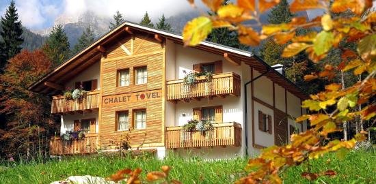
This is the only property located in proximity of the Tovel Lake. Is also only 2 minutes walk from the white-sandy beach. The Chalet offers renovated rooms with mountain views of the Brenta Dolomites, and an à la carte restaurant.
| HOW TO REACH THE LAKE?
To reach the lake is very easy — by car, head towards Trento and once near the city, follow the signs towards Tuenno. Continue with the sign for Val di Tovel, on provincial road 14. There is a parking close to the lake and the daily rate is € 8.00 in high season (summer). In any other period, it’s free. The parking is open from 8 AM until 6 PM.
Another option, if the parking spots are full, is to take the shuttle from Tuenno village. Right when you enter the town, there are two large free car parks. From there, the shuttle to the lake leaves. The ride takes 29 minutes and the fare is € 3.00 - for both ways.
☼ WHEN TO GO
I recommend visiting the lakeon weekdays, because it’s very busy on weekends. My favourite months are April and October. Autumn is special — when the colourful leaves reflect on the turquoise waters. If you want to visit it during the winter it’s possible, just make sure that the roads are open.
| HISTORY
In the past, the stretch of water was nicknamed "red lake", because this was precisely the colour of its water in the summer. Merit, or fault, of an algae called Tovellia Sanguinea which, in contact with the organic remains left by the passing herds, coloured the lake with a blood red, almost from a horror film. Now, that transhumance is less practised, the phenomenon no longer happens.

Summer of 1964, it was the last time that the lake became red
This is not the only nickname of the place, “Lake of the bears” is another name used, and understanding why is not difficult. There are many families of brown bears that live in the area and that can be observed in the surroundings. If you happen to be too close to one of these animals, keep calm and move slowly. I never encountered to see one, but we hear it often on the news, when people hike on these mountains. Rarely happens to see them down at the lake.

| ACTIVITIES
You can make the circuit walk around Tovel Lake, where you can take some scenic pictures surrounded by the Brenta Dolomites. The walk is 3 km long and it takes 1h30.
Visit the white beach — the perfect place for a picnic.
Visit the museum “Casa del Parco Lago Rosso”, where they explain the origins of the lake and how it used to transform into red waters in the past. You will find it halfway from the starting point.
Visit the waterfall “Cascata Risla`” — located 20 minutes from the main hiking trail.

10. PASSO SAN NICOLO`
CIRCUIT TRAIL
⏰ 4 h 30 • 🥾 12 km • ⛰ easy
This is a very peaceful alternative to the popular destination of “Seceda” — one of the most posted Instagram pictures in the Dolomites. The landscape is very similar, with the difference, that in Passo San Nicolo`, you will not find any crowds, and you will have the whole place for yourself.
📍STARTING POINT:
Alba di Canazei, Val di Fassa, Italy
✔ LOCATIONS:
Ciampac - Sela Brunech - Forcia Neigra - Passo San Nicolo`- Val de Contrin - Alba check the map
⇢ TRAILS:
613 - 648 - 602
| ELEVATION:
from 2428 m - to 1736 m
| PRICE:
€ 14,00 (cable cars)
☒ACCOMODATION:
Appartamenti Arnica

The apartments are located close to the cable car. Alba di Canazei is a queit location, away from the crowds of tourists of Canazei. I recommend you staying in this village, is you prefere a more relxing enviroment.
| HOW TO REACH THE HIKE?
From Alba di Canazei, take the cable car to Ciampac. Continue the walk for 5 minutes, and you will see a chair lift going all the way up to the plateau of Sela Brunech.
Once arrived at the top, that’s where the hike begins, so take the path n.613 towards Forcia Neigra and continue the flat trail n.613 direction Passo San Nicolo` . Here, is where my favourite part of the hike begins, with the classic ridge panoramic path to the summit.
Trail n. 613 - The perfect picnic spot
The trail doesn’t require any particular effort, and the view is remarkable — at your feet extends the very green valley called “Passo San Nicolò” . From the top, you can also see the Catinaccio, Pordoi, Sella mountain group, and the majestic Marmolada glacier.
The trail n.613 will take you towards the mountain restaurant called Rifugio San Nicolo` (see picture below)

The hut of Rifugio San Nicolo`
Once reached the mountain hut of Rifugio San Nicolo`, take the path n.648 towards Valle Contrin.
Continue the hike in the Contrin Valley, path n.602, following the indication to Baita Locia Contrin — the trail next to the stream that leads all the way down to the starting point of Alba´s cable car.
| ☼ WHEN TO GO
I recommend going during the summer, in July - August, or early September, to enjoy the vivid green colours of this beautiful mountain ridge. It is NOT a popular place in the Dolomites, so you don’t have to worry about finding too many tourists around.